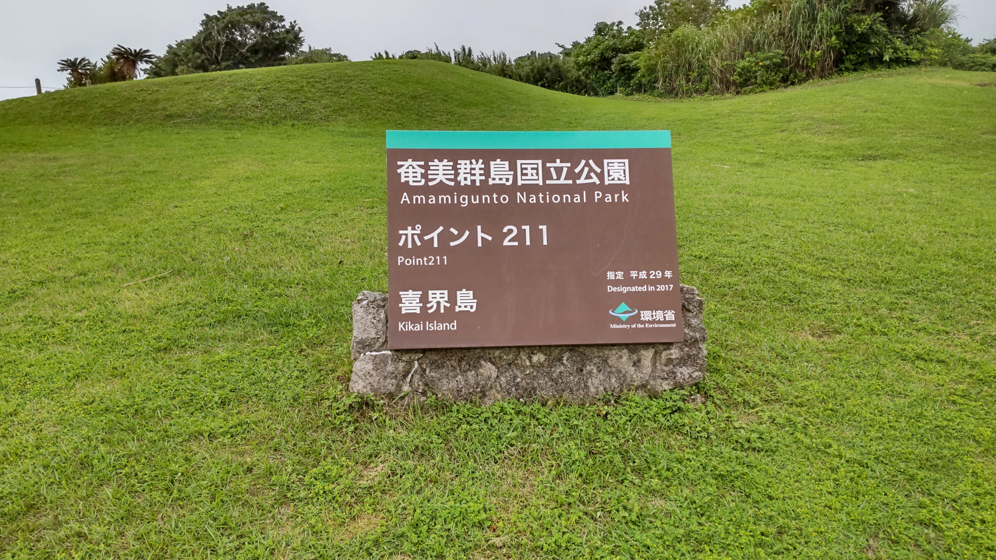
I moved to Kikaijima this month to start my new job at the KIKAI Institute for Coral Reef Sciences. I want to show off the wondrous island of Kikaijima, and what better place to start than the top! Point 211 is also known as 七島鼻 (しちとうばな – Shichi Tou Bana). The name might translate to “Seven Island Nose”, though I am not sure of the precise reason it is called this. Point 211 is the highest point of the island.
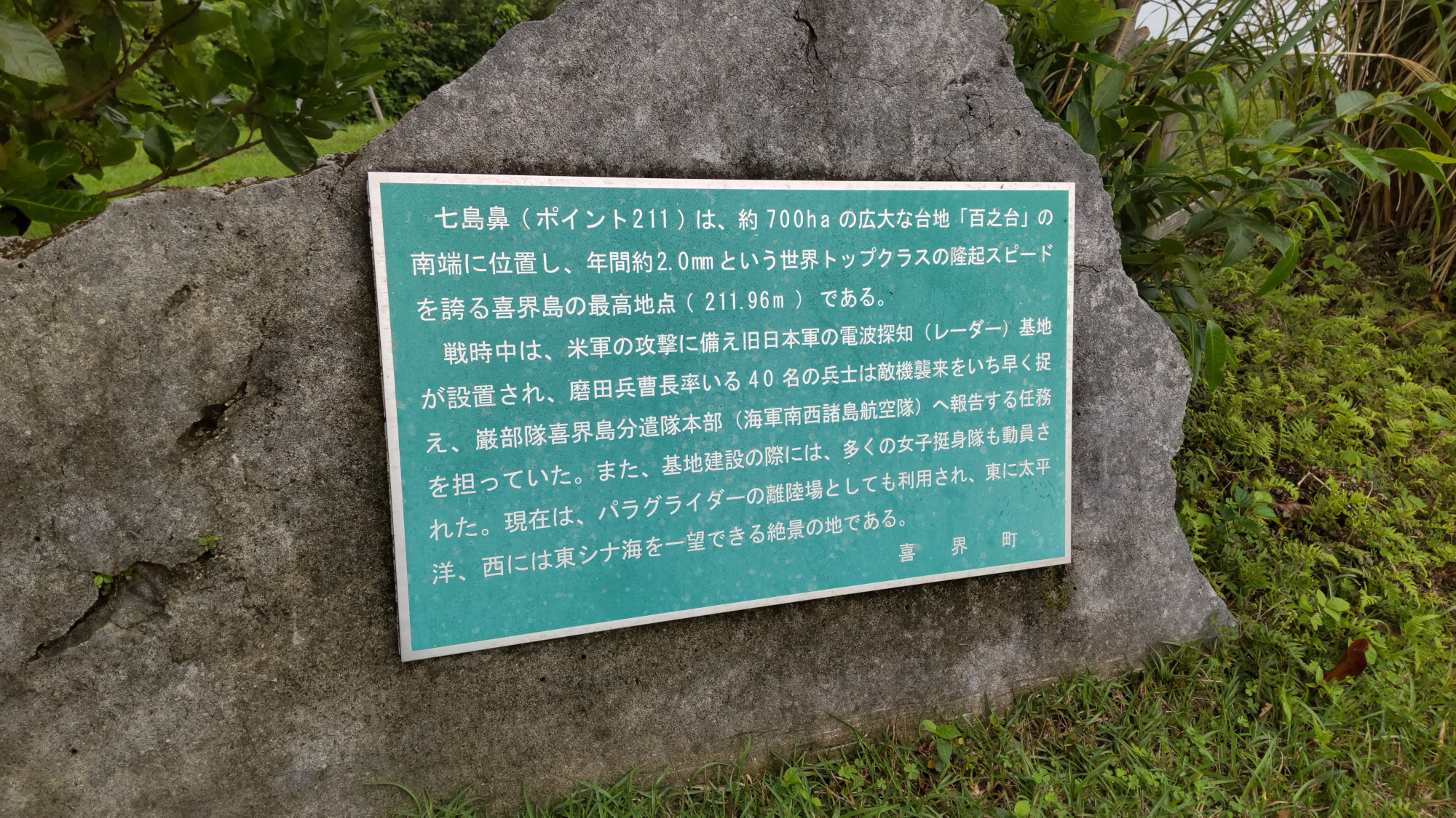
The sign above tells of some of the main things at Point 211. The area around Point 211 is about 700 ha, and is part of 百之台 (Hyaku no Dai — “100th Pedestal”), a plateau (or rather, terrace) at the top of the island. Every year, the island is tectonically uplifting at about 2 mm/yr, and the peak elevation is 211.96 m (as of 2007). They are really proud of the fast uplift rate! One of the darker moments was during World War II, and Point 211 was the site of a radar station. There were 40 people from the Japanese navy stations here. It makes a mention that a lot of women were also working here at that time. However, Point 211 is now a popular paragliding spot.
Let’s first start with the namesake portion of the area.
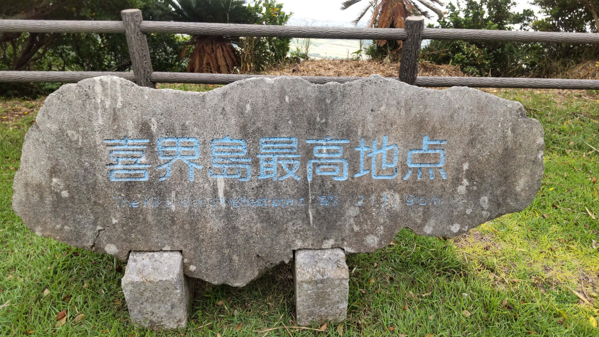
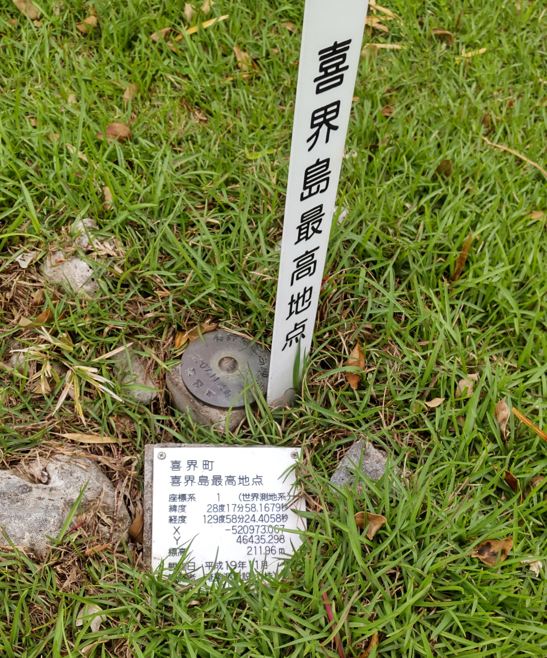
Kikaijima is 211.96 m high, measured on Heisei 19 in November (2007). However, with an uplift rate of 2 mm/yr, it will reach 212 m in a 20 year period, meaning that next year they might need to rename it “Point 212”! If I manage to get a differential GPS unit, you better believe I will be measuring it.
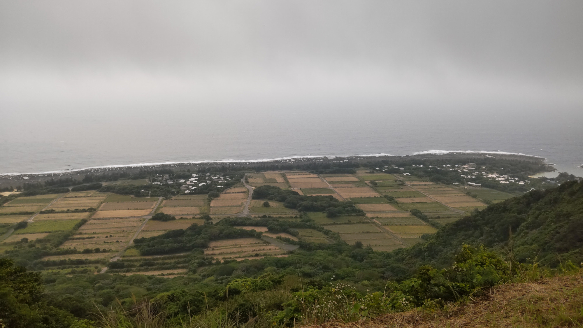
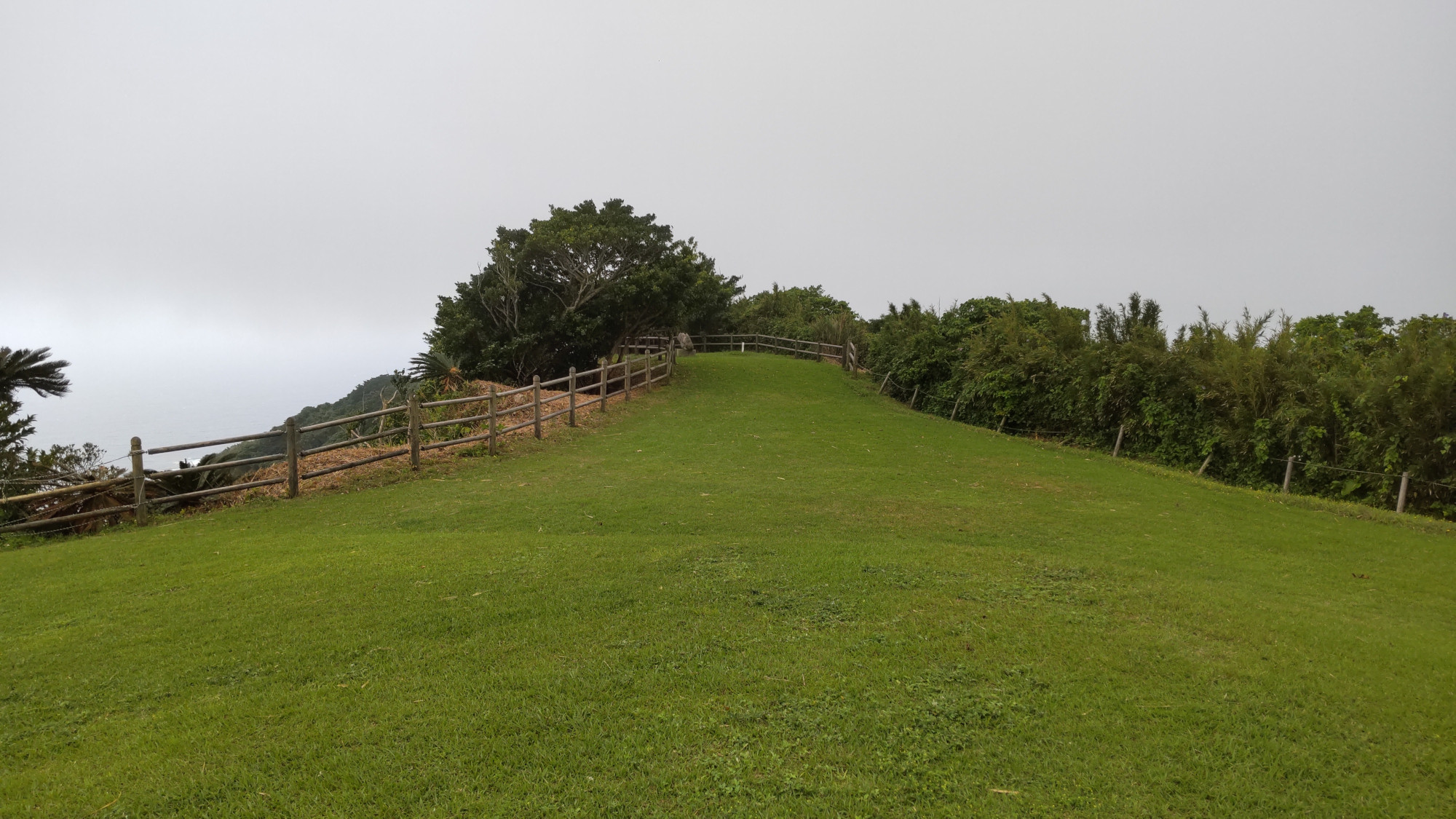
From Point 211, you can get a good view off the village of Keraji, which is situated on the Holocene coral reef terrace. This formed during the past 7000 years, and provides a flat area for agriculture (mostly sugar cane). Alas, it was kind of cloudy the day I went here.
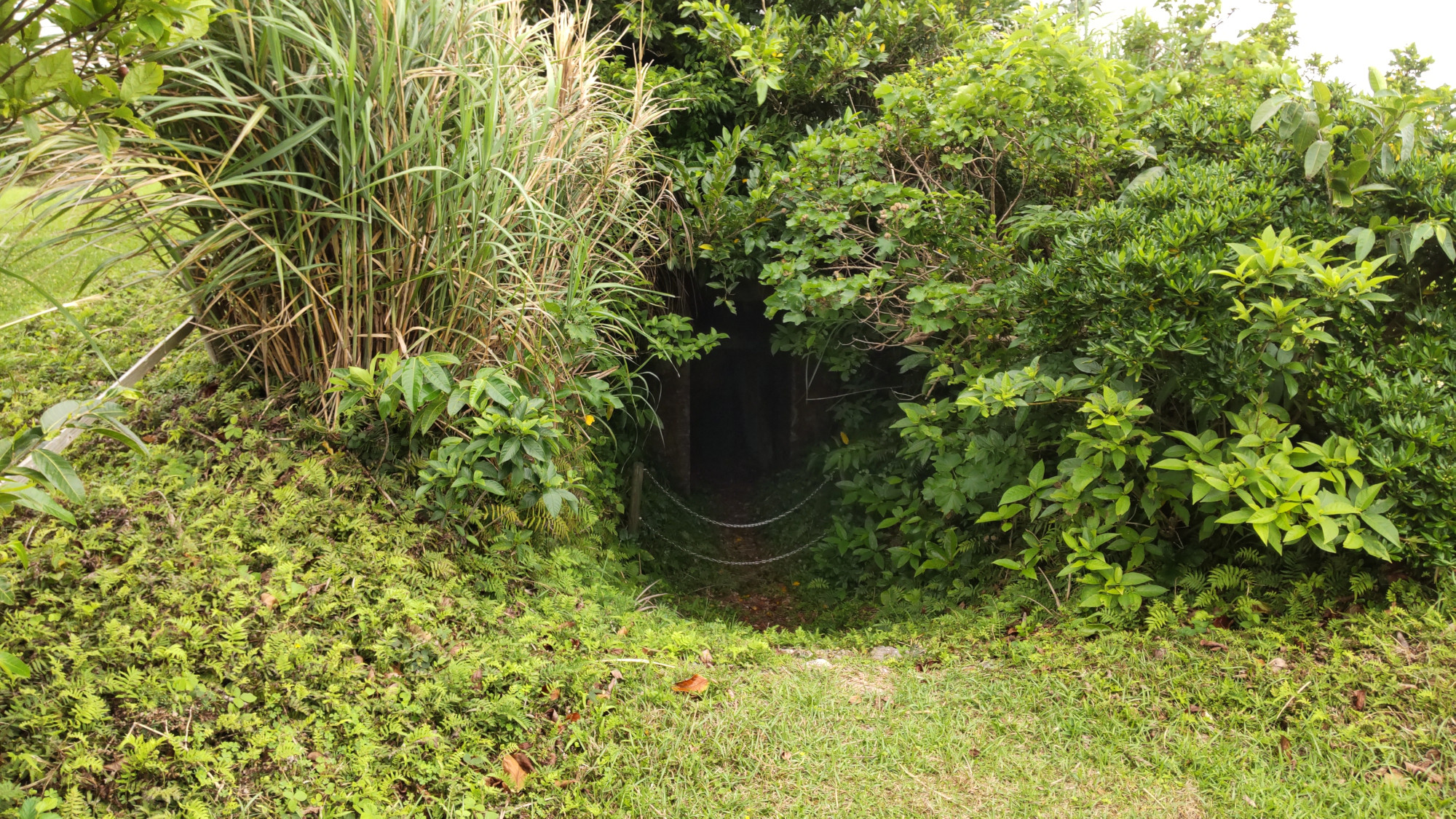
Of course, being the highest point of the island means that during World War II, it was a logistically important place. There are bunkers throughout the island, but Point 211 was an important radar station.
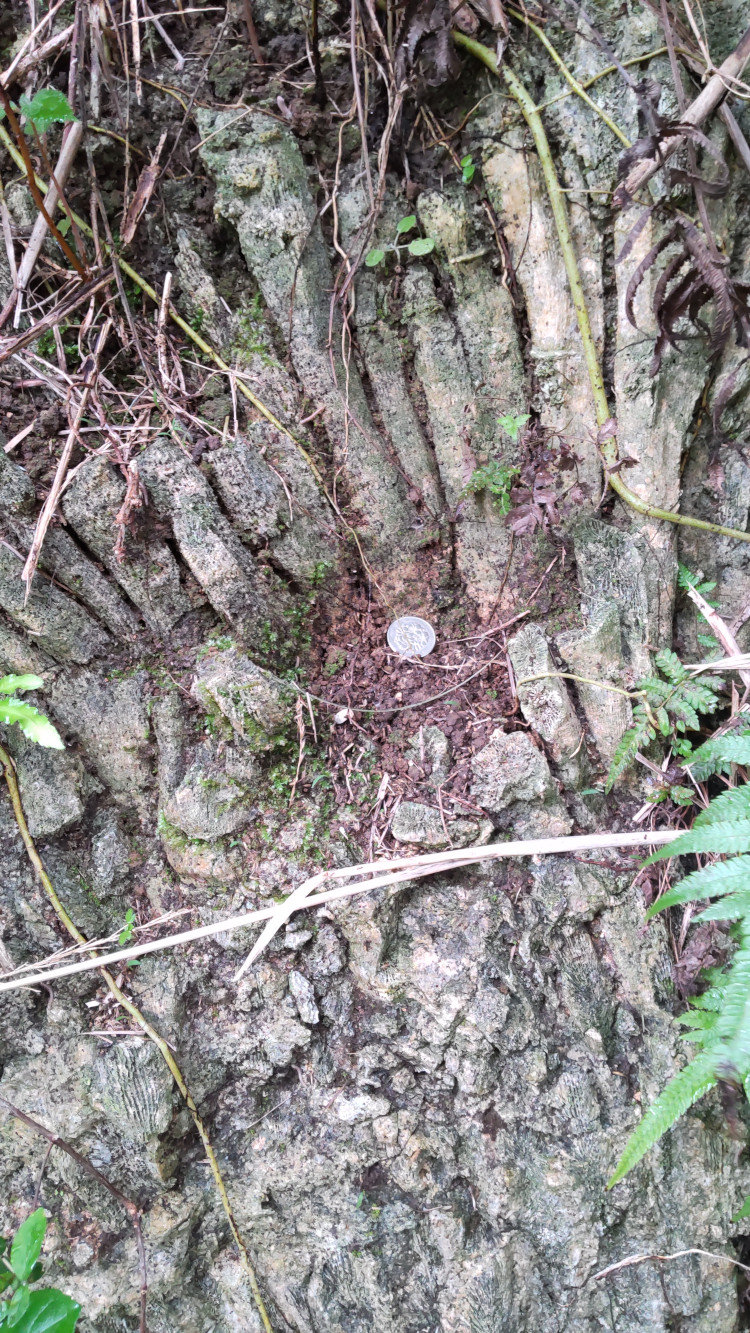
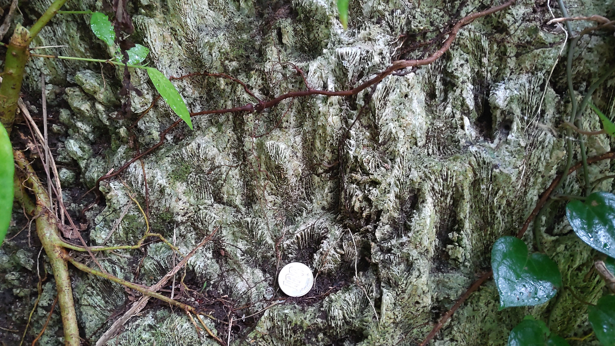
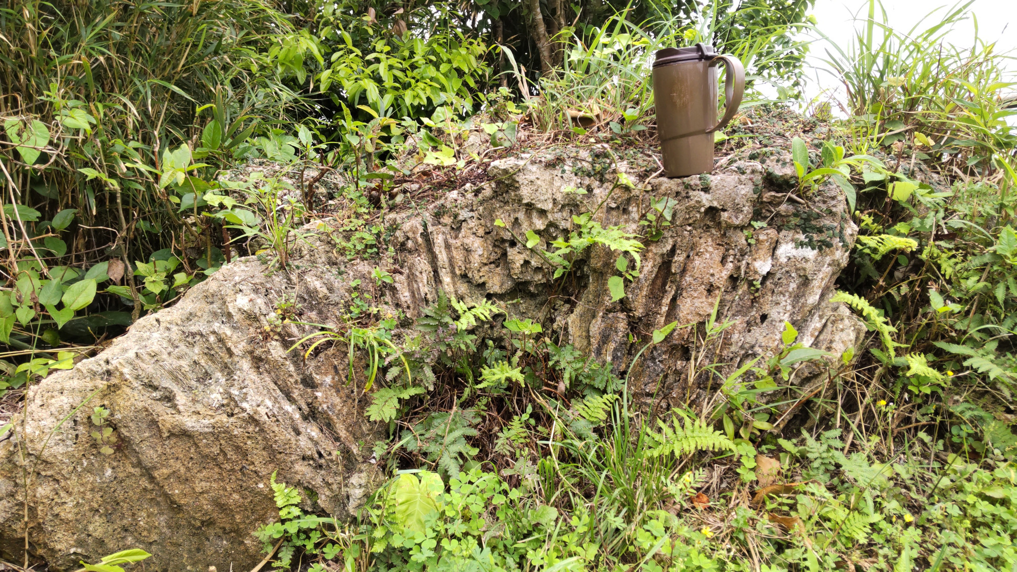
Of course, I came to Kikaijima because it records records of past sea level, in the form of fossil corals. The corals at Point 211 are about 100,000 years old, dating to a period known as Marine Isotope Stage 5c. We know that the uplift rate of about 2 mm/yr has been pretty steady during the past 100,000 years because of these fossils. Though we do not know precisely what sea level was during Marine Isotope Stage 5c, it was probably between 0 and 20 m lower than it is now. The coral fossils found here and the presence of the Hyaku no Dai terrace indicates that sea level on the island at that time was probably relatively close to what sea level was at that time. So, if we had a rate of 2 mm/yr, that means 200 m of uplift in the past 100,000 years, which is close to the elevation here. Here are some fossils that you can see here!

You must be logged in to post a comment.