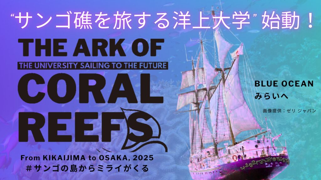
From September 14 to 23, 2025, I had the great pleasure to attend the The Ark of Coral Reefs cruise. It was a cruise to commemorate the 10th anniversary of the founding of the Kikai Institute for Coral Reef Sciences. This cruise was aboard the schooner Miraie. “Miraie” (みらいへ) means “towards the future” in Japanese, an appropriate name for this cruise. The ambition of this cruise is that it was like a “floating university”. The people on board were scientists and researchers, graduate students, artists, and local representatives from Kikaijima. I will elaborate on this in subsequent posts. I want to thank Tsuyoshi Watanabe and Atsuko Yamazaki for inviting me to come!
The cruise departed from Kikaijima with a destination of Osaka. There were stops at Yakushima, Tatsukushi, and Inujima. I arrived in Kikaijima on the evening of September 19th.
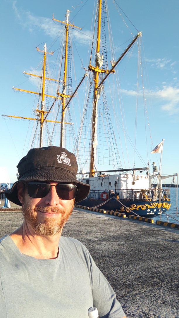
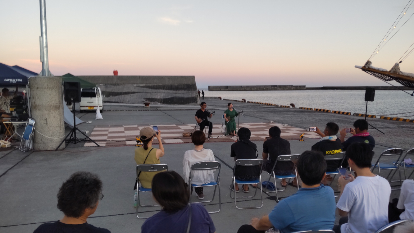
The first day was just the arrival. The Kikai Institute is located in a town called Somachi. This town has a ferry terminal where the Miraie was docked. We were greeted with a party to celebrate the start of the cruise.
I am hoping to do a blog post describing every day of the trip. Since the first day was short, I will introduce why Kikaijima is such a special place.
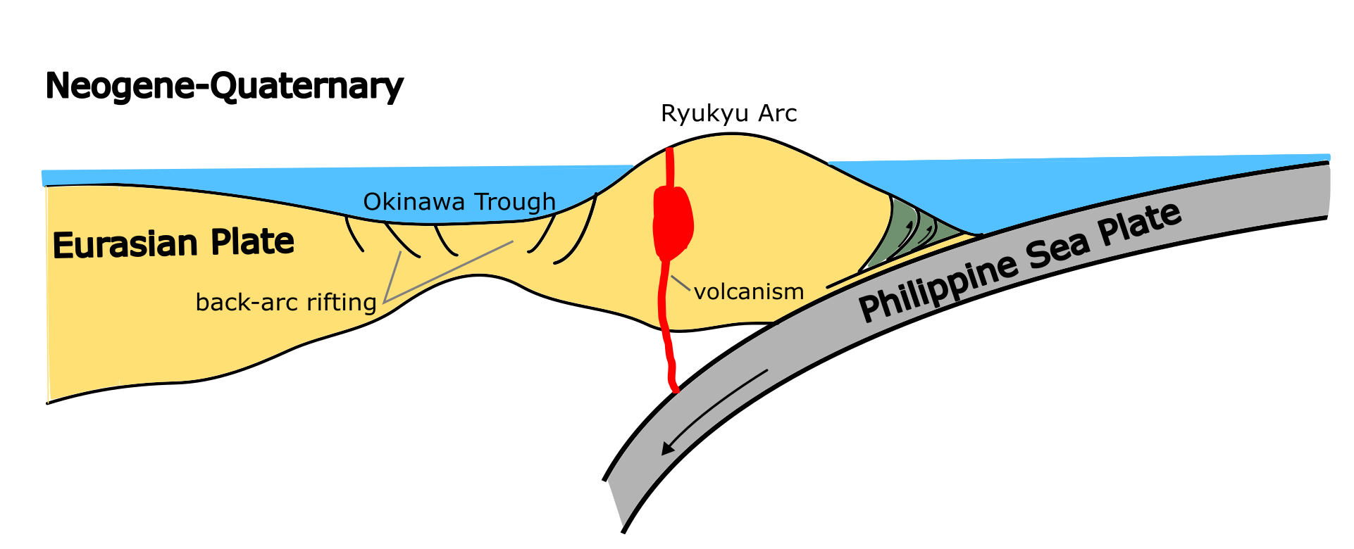
Kikaijima is a small island in Kagoshima Prefecture, located in southern Japan. It is part of the Ryukyu Islands, a chain of islands that form along the subduction zone where the Philippines Sea plate goes underneath the Eurasian Plate. Kikaijima exists as a consequence of this. As the Philippine Sea Plate collides, it causes the land near the subduction zone to rise. In the case of Kikaijima, it amounts to a rate of close to 2 mm/year, at least for the past 100,000 years.
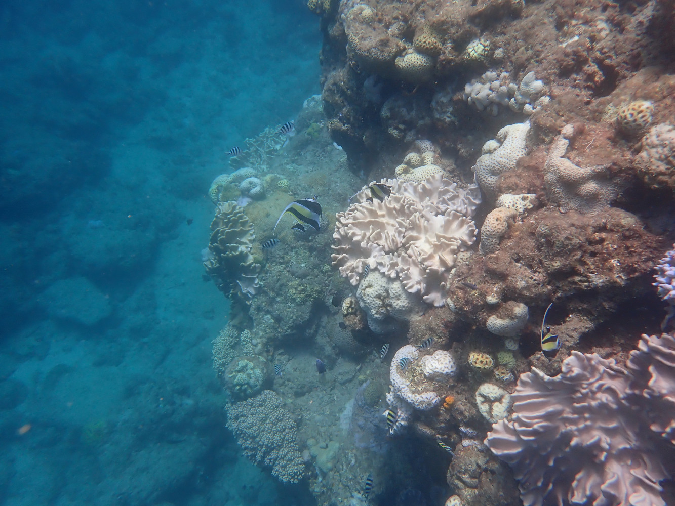
Kikaijima is an island rimmed with coral reefs. The reefs remain in a relatively pristine state, which is why it is such a great place for the Kikai Institute for Coral Reef Science. The picture below is taken at Somachi, the town where the institute is located. In fact, this photo shows the corals growing on the harbour infrastructure where the Miraie was docked.
Kikaijima has existed as an island since about 100,000 years ago. Before that, it is possible that the island did not exist, though the evidence is a bit fragmented. Regardless, the entire island is covered by fossil coral reefs. Even at the highest point of Kikaijima, now 211 m above present sea level, you can find fossil corals.
It is likely a good assumption that Kikaijima has been uplifting at a relatively constant rate for the past 100,000 years, based on what we know about global sea level changes. Global sea level fluctuated as a result of the growth and retreat of ice sheets covering North America and Europe (as well as fluctuations of existing ice sheets in Antarctica and Greenland). At the peak of the last glacial period, about 20,000 years ago, global average sea level was 120-130 m lower than present. For much of the past 100,000 years, global sea level probably fluctuated between 10 and 100 m below current sea level. Sea level 100,000 years ago was likely only a few meters below present sea level, so the 211 m high point on Kikaijima fits nicely with an uplift rate of about 2 mm/yr.
This uplift of the island combined with global sea level fluctuations during the past 100,000 years produces a unique landscape of ancient coral reef terraces. These are relatively flat places that likely formed when uplift of the island and the change global sea level was in balance.
During the past 7000 years, global average sea level has remained relatively stable, with fluctuations that are less than 1 m. Since Kikaijima has continued to uplift, this means that the island has been growing. The coral reefs that grow around the island have been thrust out of the water, in what seems to be 4 discrete events. The roughly 2 mm/yr uplift rate might just be a long term average! The uplift of the island is likely caused by large megathrust earthquakes that happen every 1000-2000 years that instantaneously raise the island by 1-3 m. There are four distinct terraces from these events that happened in the past few thousand years years, with a sudden change in elevation between them.
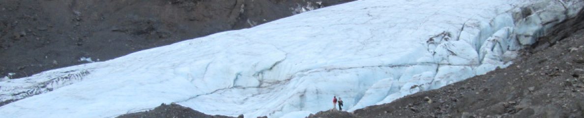
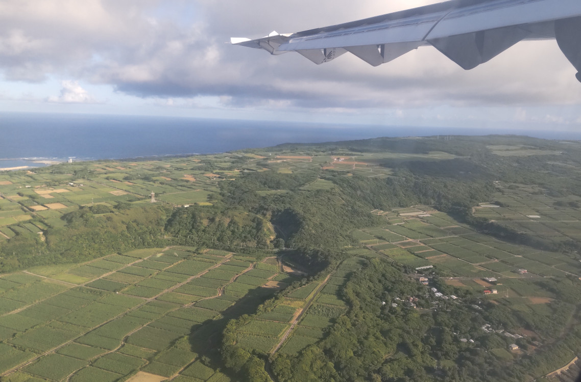
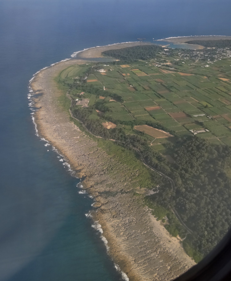
The picture below shows the northern part of Kikaijima. All around the island, there is this rim of grey rock where no plants are growing. These represent some of the younger fossil coral terraces that formed during the past 4000 years. I suspect that the reasons there are few plants is because of the lack of soil (obviously), but also that these rocks are still exposed to storm waves, which would discourage the growth of plants that cannot tolerate salt water.
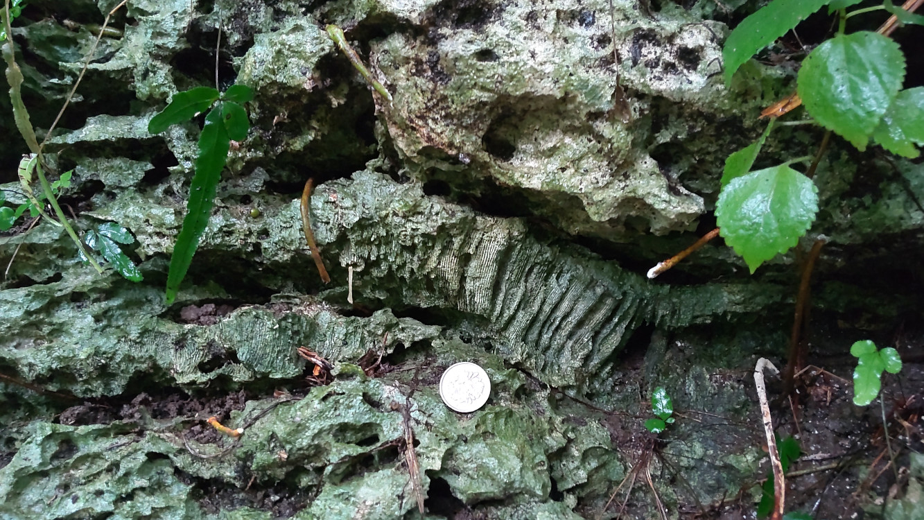
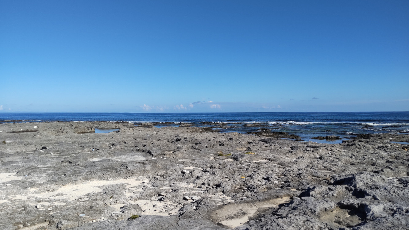
From the ground, you can see what I mean by the fact there is not much for plants to grow on. The rocks are jagged and hard to walk on. Shoes or boots are definitely recommended.
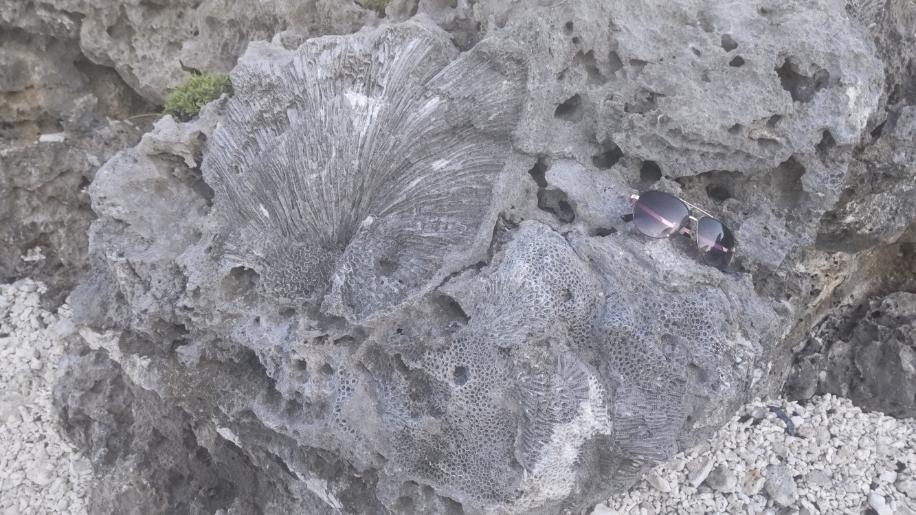
Up close, you can see why it is such a wonderous place, at least if you are a budding paleontologist. There are fossils everywhere! I am just a modeller, so I can’t tell you want the fossils are beyond saying that they are corals. If you do identify the fossils, you can deduce what the past sea level position was, because different coral species will live at different water depths.
The remarkable thing about Kikaijima are that some of the fossil coral reef terraces formed between 40 and 70 thousand years ago. During this time period, there are few constraints on what past sea level was, and subsequently it is hard to deduce what the past ice volume was. This is a big problem for me! However, despite its uniqueness, Kikaijima is less well known in the sea level science community than similar sites in Papua New Guinea and Indonesia. I want to change this!
I first found out about Kikaijima from a poster presented by Atsuko Yamazaki, who is the director of the Kikai Institute, at the 2022 Japan Geoscience Union conference. The poster showed a map of the age of the terraces of Kikaijima, some which dated to this period known as Marine Isotope Stage 3 (between 55 and 27 thousand years ago). I am very interested in this period! Yamazaki-san invited me to come to Kikaijima to participate in the activities at the Kikai Institute that summer. I will elaborate on this a bit more in the next post, but needless to say, the overarching goal of the Ark of the Coral Reefs cruise to connect scientists, artists and local residents is a project I find to be very interesting.
One of the things I did the first time I went to Kikaijima was to make a video showing the evolution of the island over the past 80,000 years using my paleotopography reconstruction, PaleoMIST. I updated it in 2023 with some modifications to make the ice sheet history during the past few thousand years a bit more realistic. I uploaded the video, so you can watch as the island grew and shrank in response to tectonic uplift and global sea level changes!
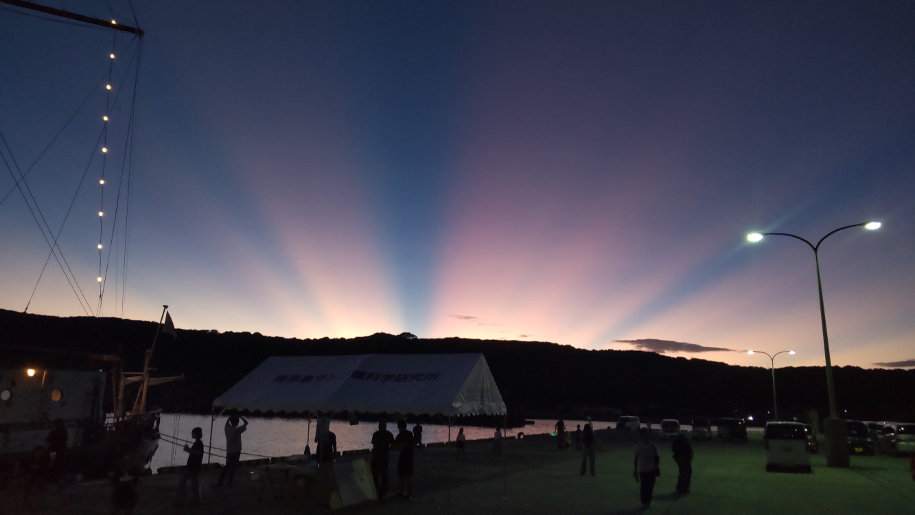
Just as the sun set on the first day of our adventure, we were greeted a most beautiful sunset, which I felt was a good omen for the trip. I suspect it was caused as the sun set behind the nearby Amami Island, and the streaks were caused by its topography. I don’t know for sure, but it was amazing! In the next post, I will describe in more detail some of my activities at the Kikai Institute for Coral Reef Sciences.

You must be logged in to post a comment.