I named this website over the fact that so-called “raised beaches” are a key constraint that I use to infer the size of past ice sheets. As I discussed in episode 1 one of my podcast, the term “raised beaches” was used as a description of beaches in different parts of the world that now have no connection to the modern coastline. The original hypothesis, promoted by Charles Lyell and Charles Darwin, was that these raised beaches were a consequence of the land rising. This was something that was directly observed when looking at the consequences of the 1822 Valparaíso earthquake in Chile. We now know that uplifting land is not responsible for all raised beaches, since glacial isostatic adjustment processes change sea level position through the addition and removal of water in ice sheets, and related changes to the Earth’s gravity and rotation.

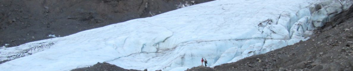
In Scotland, though, the raised beaches are a consequence of uplifting land. These beaches have been investigated since the early 1800s, and were used even then as proof the land there was uplifting. This is also a consequence of glacial isostatic adjustment processes, as the weight of the ice sheets in the last glacial period pressed down on the land. After the ice melted away, the land rebounded as the weight was removed. During the Last Glacial Maximum, between about 26 and 19 thousand years ago, Scotland was completely covered in ice.
Last month, two papers on raised beaches in northwestern Scotland were published. These papers have mostly the same authors, and involve scientists from the US and Britain. The first, by Huffman et al., concerns some of the earliest raised beaches that were created after the Last Glacial Maximum when the British-Irish Ice Sheet that covered Scotland began to retreat. The second, by Simms et al., concerns raised beaches that are older than the Last Glacial Maximum, and are from a time period know as Marine Isotope Stage 3, which lasted between 55 and 27 thousand years ago.
For me, it was pretty exciting to see these papers, because I reviewed the National Science Foundation (NSF) proposal that led to this work back in 2021. It is nice to see that the proposal was funded and that it was so successful.
These studies focused on finding ages of the raised beaches. They used a technique known as optically stimulated luminescence (OSL). The benefit of this technique over the more commonly used radiocarbon dating is that it does not require organic material (which is not commonly found in early deglacial beaches), and that it can produce more reliable ages for material that is over 20,000 years old. At 20,000 years, radiocarbon has already gone through about 4 half-lives, and less than 10% of the original radiocarbon remains. Contamination is very easy at that level.
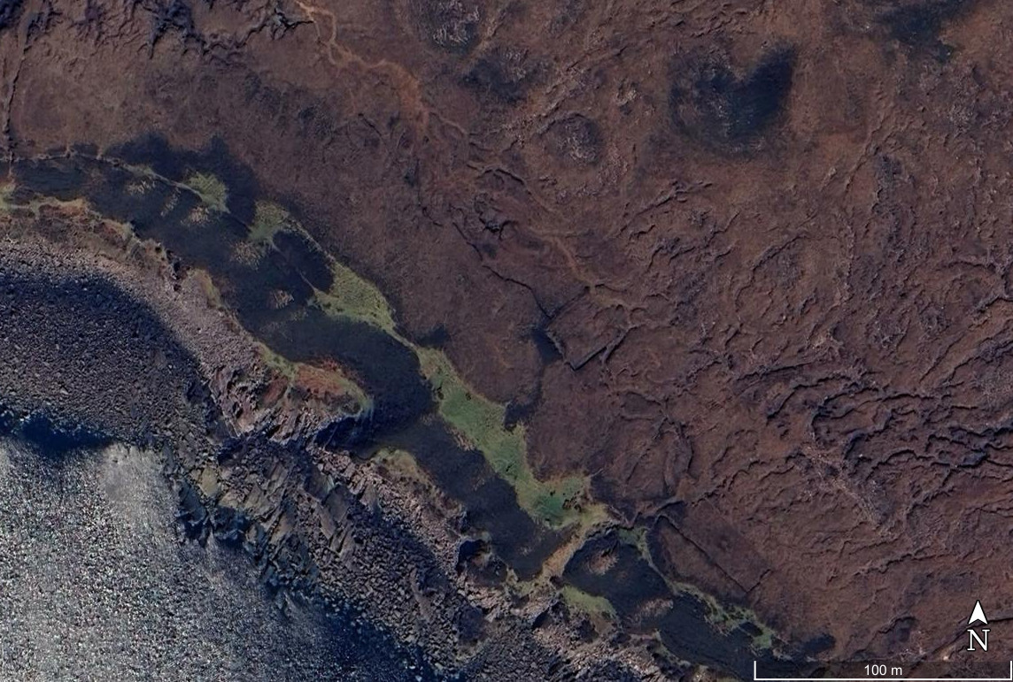
“Luminescence” is the brightness of a mineral when it is struck by a laser. I won’t go into the details of OSL dating, but there are a few things that you need to know to understand the technique. The first is that the material dated is the sand from the beach itself. The second is that the luminescence signal is reset if the sand is exposed to sunlight. The third is that the longer the sand is buried, the stronger the luminescence signal is. Thus, if you measure how strong the signal is, you can infer how long the sand has been buried. When collecting the sand samples, you have to be very careful not to expose it to sunlight. You also have to hope that before the sand was buried, it was exposed to sunlight, which is not always the case.

In the Huffman et al. study, they investigated a number of postglacial beaches. However, their measurements show that the assumptions made for OSL dating sometimes do not work out. They collected 26 samples, but only 7 of them seemed to conform to the expected ages of the beaches. Some of them were close, but were a bit older than previously inferred deglacial ages. Maybe those are right! If so, the ice sheet retreat history will have to be refined. Some of the ages were over 100,000 years older than expected. This indicates either that the sand was reworked from an older deposit but not exposed to sunlight, or that the beach is a composite of deglacial beach and a beach dating from before the Last Glacial Maximum.
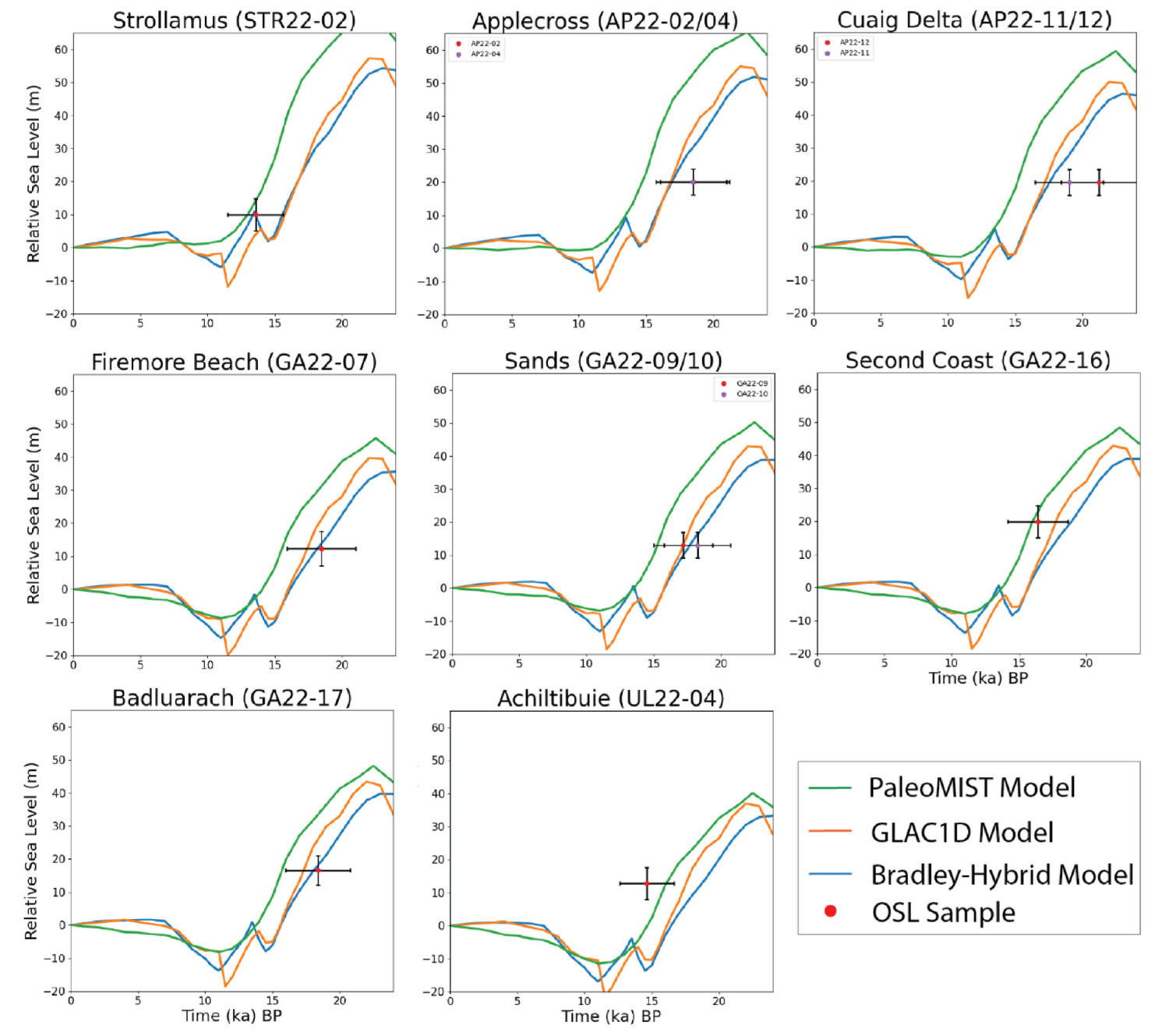
I would be remiss if I didn’t post about the calculated sea level analysis in this paper, which includes my ice sheet reconstruction, PaleoMIST. PaleoMIST did not use the paleo sea level observations in Scotland to refine the reconstruction, so it is interesting to see how it compares to other models. Indeed, PaleoMIST does not fit as well as the other two models they used, GLAC1D and the Bradley-Hybrid Model (in which the Eurasian ice sheets in the GLAC1D model were modified during the late glacial period). The modelled sea level tends to be too high. I have made new reconstructions of the ice sheets, which should come out later this year. I have not added these new data to my sea level database, but I will be sure to do so before my new model comes out and see how it compares.
The second paper by Simms et al. looks at an older marine terrace that predates the last glaciation of Scotland. This is quite remarkable, since the flowing ice of ice sheets generally destroys unconsolidated sediments that are at the surface. The terrace seems to be above the highest shorelines that postdate the last glaciation, indicating qualitatively that it has be be older than the Last Glacial Maximum.
The OSL dates from deposits in this terrace gave ages of between 49 and 54 thousand years ago. This is the early part of the period known as Marine Isotope Stage 3. This was a time after a fairly major glaciation in the last glacial cycle known as Marine Isotope Stage 4. In Marine Isotope Stage 4, an ice sheet formed over parts of northern Europe, though the dimensions are quite uncertain due to erosion from the generally more extensive glaciation during the Last Glacial Maximum. During Marine Isotope Stage 3, the geological evidence collected during the past 10 years indicates that the European ice sheets largely melted away in the early parts of that stage.
That there are raised marine deposits above present that date to about 50,000 years ago is pretty strong evidence that Scotland was glaciated during Marine Isotope Stage 4. Globally, sea level was likely at least 35 m lower than present during Marine Isotope Stage 3, even at their peak. Having raised deposits is strong evidence that the land was depressed by ice sheets. Simms et al. compared the calculated sea level after the Marine Isotope Stage 4 glacial period from the Bradley-Hybrid Model and PaleoMIST.

The major difference between the PaleoMIST and Bradley-Hybrid ice sheet reconstructions is that the PaleoMIST reconstruction includes glaciation of Scotland during Marine Isotope Stage 4, while the Bradley-Hybrid Model does not. The calculated sea level from northwestern Scotland in the early parts of Marine Isotope Stage 3 are much higher than the Bradley-Hybrid model, despite the global average sea level in PaleoMIST being lower. The PaleoMIST reconstruction is better able to explain the presence of the raised marine terrace in early Marine Isotope Stage 3, providing robust evidence of a Marine Isotope Stage 4 glaciation that would have pressed down on the land.
As mentioned above, I am in the process of revising the PaleoMIST ice sheet reconstruction. The late glacial part of the reconstruction is finished, but from the above information, the Marine Isotope Stage 4 glacial reconstruction may need refinement. If things go well, this will be out later this year!

You must be logged in to post a comment.